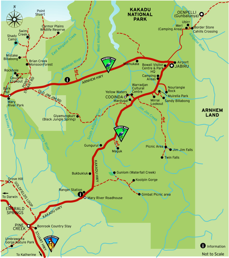
Kakadu National Park Map
Use the Kakadu National Park map below to help plan your visit and understand the distances between key areas of the park. Kakadu is a large national park, so allowing enough travel time between attractions is important when planning your itinerary.
The map shows the location of key areas within Kakadu National Park and can help when planning visits to Jabiru, Cooinda, Ubirr, Nourlangie Rock Art Sites, Yellow Water Billabong and other attractions throughout the park.
Planning Your Kakadu Trip
Road conditions and seasonal access can affect travel within Kakadu, particularly to waterfalls and some 4WD areas. When planning your trip, consider the distances between attractions, where you will be staying and how much time you have available.
For more help planning your visit, see our Kakadu Driving Distances and Kakadu Travel Guide.